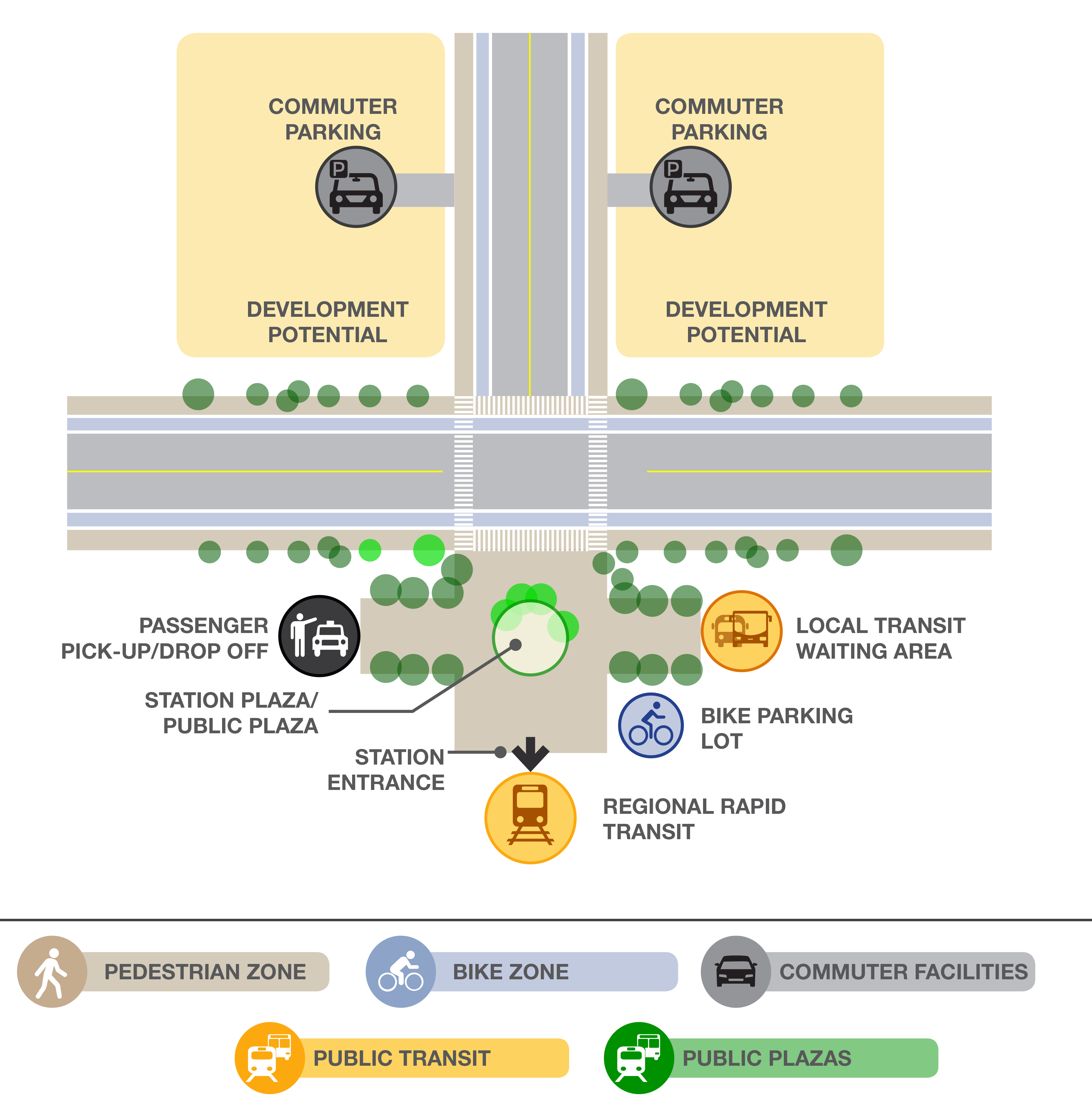
WHAT IS A MOBILITY HUB?
A Mobility Hub comprises of a well-designed transit station and surrounding area that allows for seamless integration of all modes of transportation with a high-quality user experience. It brings together an intensive concentration of work, live, shop and play experiences that are comfortably accessible by foot, approximately a half-mile radius or within 10-minute walking distance. In addition, mobility hub also serves as the origin, destination, or transfer point for a significant portion of trips.
WHAT IS TOD?
TOD is Transit-Oriented Development. A TOD is defined by the American Planning Association as “a project or projects that are served by existing or planned transit service. They are compact, moderate to high-density developments, of mixed-use character, interconnected with other land uses, bicycle and pedestrian friendly. TODs are designed to support transit services separately or combined: heavy and light rail, fixed guideway, streetcar, or bus systems on dedicated facilities and through available roadway connections”.
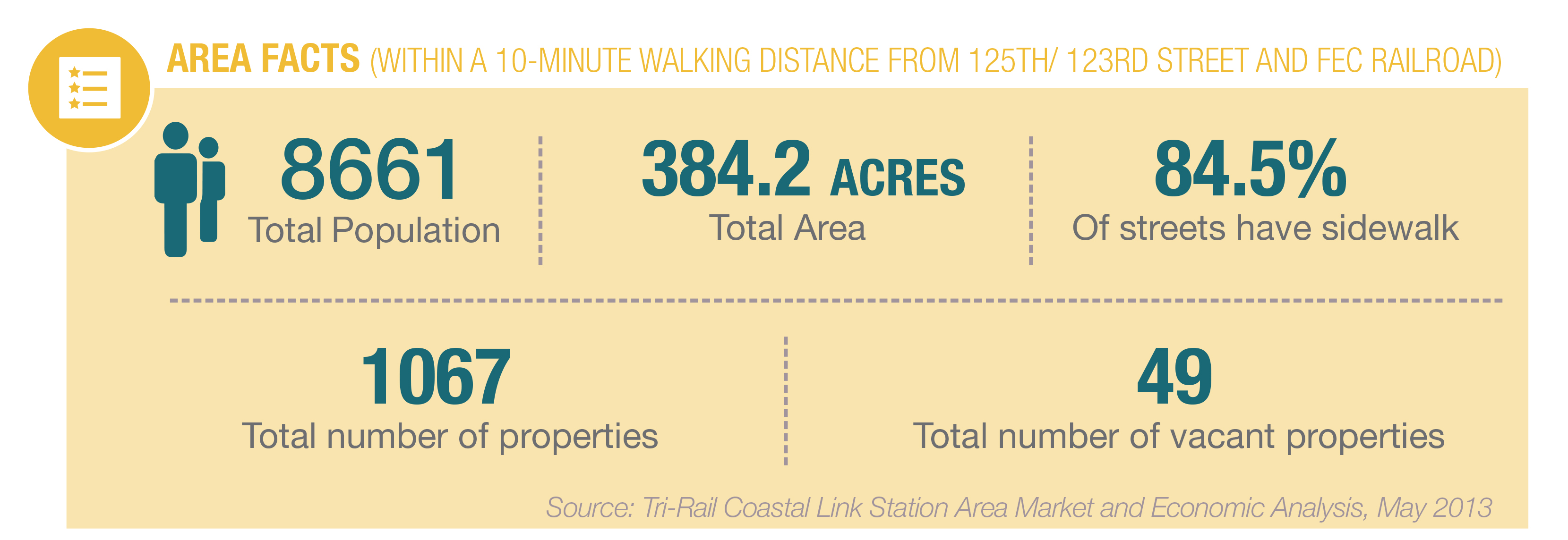
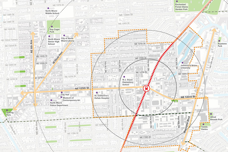
STUDY AREA
The North Miami Mobility Hub & TOD Planning Area is strategically located within the city limits, serving as a critical link between the Downtown CRA/ Central Business District and Biscayne Boulevard (US 1). The map identifies the planning area for this study. The City of North Miami, home to over 62,000 residents (2015 Census estimates), is situated 10 miles north of Downtown Miami- the center for one of the fastest growing economic regions in the country.
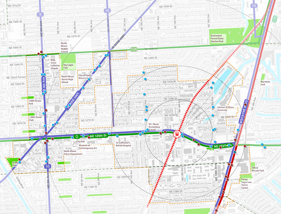
TRANSIT IN STUDY AREA
The study area is well served by transit. At present, the study area is served by Miami-Dade Transit (MDT) bus routes and local shuttle service, NoMi Express connecting to area destinations. In addition, the City through FDOT funding recently embarked upon a Complete Streets design intervention for 125th Street that will help enhance the pedestrian and cycling infrastructure in one of the city’s most traveled arterial roads. The city also recently signed a contract with a LimeBike, a private dockless bicycle sharing program to provide this service to North Miami residents.
The other planned transit initiatives, including the Tri-Rail Coastal Link and the Strategic Miami Area Rapid Transit (SMART) Plan (Northeast Corridor) emphasize the need to better connect the region’s urban centers with each other through public transit systems.
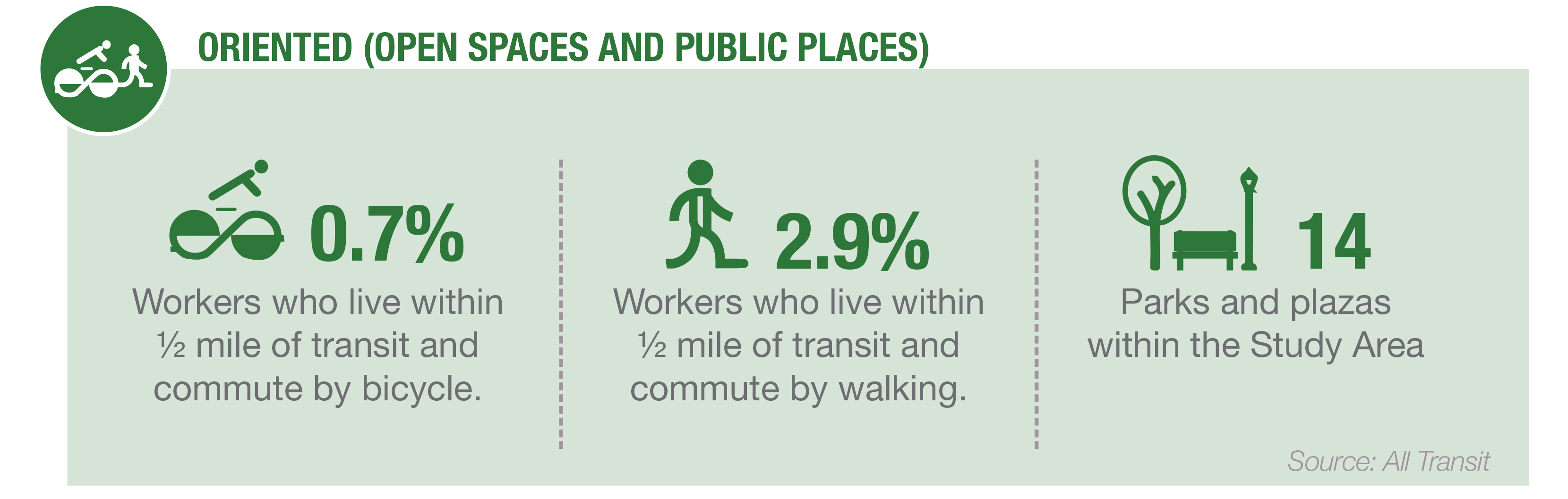
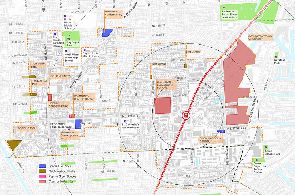
OPEN SPACES IN STUDY AREA
There are many “parts and pieces” that create a “place” in the Study Area – art & wall murals, indigenous architecture, tree canopy, signs and wayfinding monuments, unique gathering spaces and cultural features. Sometimes they are the spaces between buildings; back alleys, neglected courtyards, and stairways may escape our notice. These are nonetheless among NoMi’s most underutilized and potentially valuable assets as demonstrated by local “tactical urbanism” events designed to temporarily recapture small urban spaces along roadways and in service alleys. Used together, these features can equally enhance large areas like the NoMi Station Area or small special places like Liberty Square Park located on the north side of NE 125th Street near NoMi Plaza.
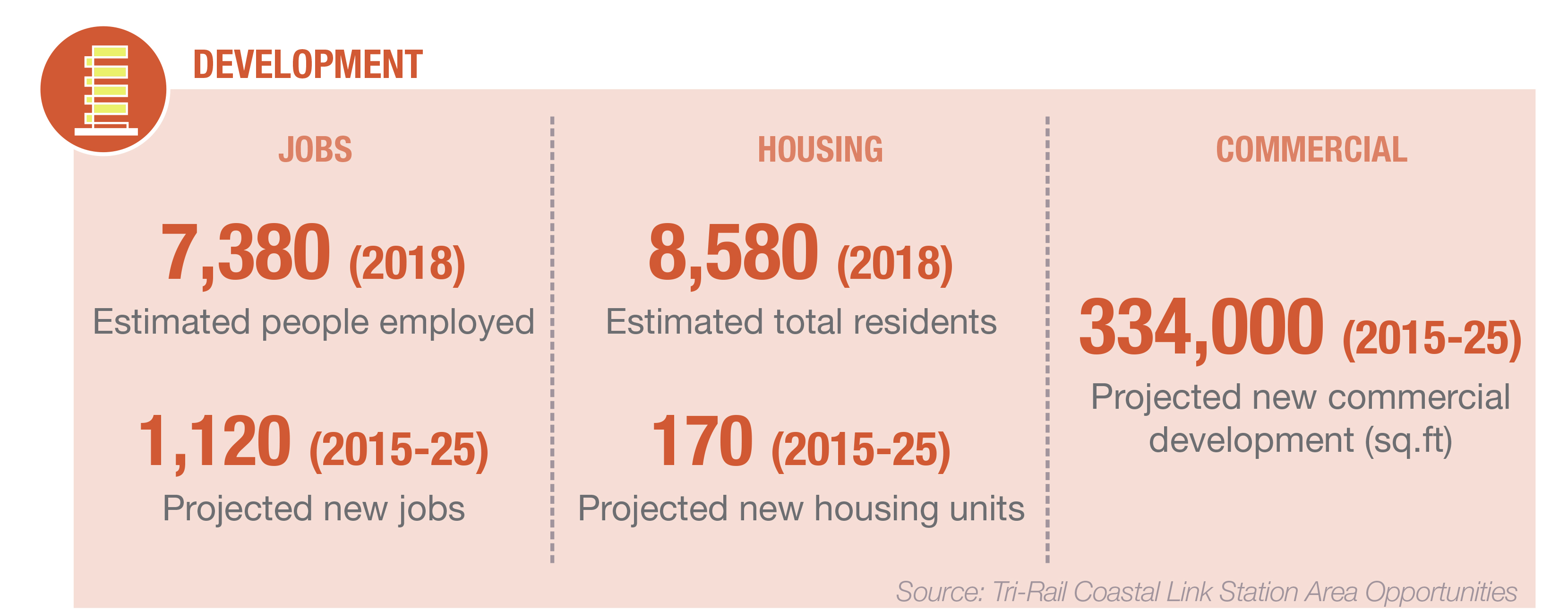
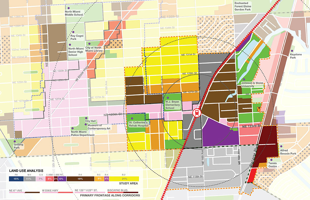
DEVELOPMENT IN STUDY AREA
From a development standpoint, the 2036 Future Land Use Map (FLUM) identifies a concentration of industrial areas between 143rd Street and 151st Street and properties along the FEC railroad between NE 121st Street and NE 135th Street. Medium and High density residential/ mixed use developments (from 25du/ acre to 100 du/acre) are proposed in the FLUM in the following locations and illustrated on the map